Detecting urban typology from multispectral satellite imagery using neural networks
|
|
|
|
|
|
|
|
|
|
The data
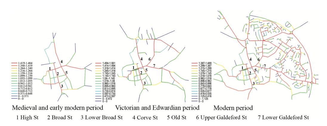
 Fu et al. (2022)
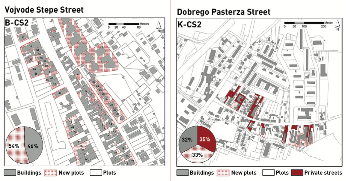 Kantarek et al. (2022)
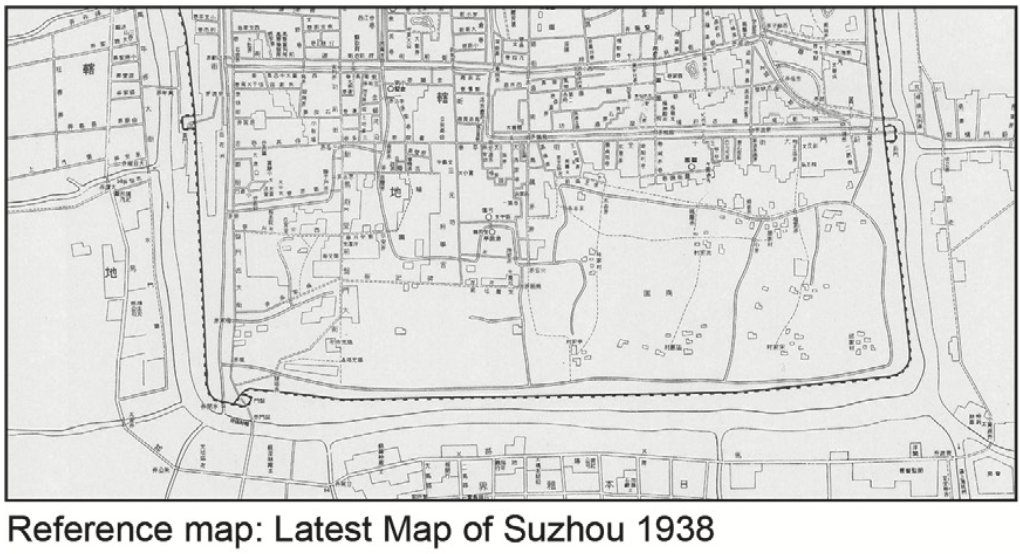
 Guo and Ding (2021)
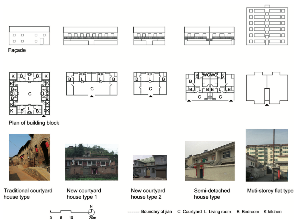
 Li and Zhang (2021)
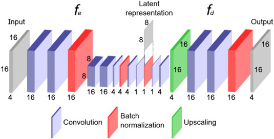
The solution (?)
🛰
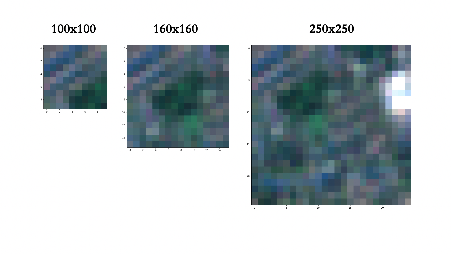
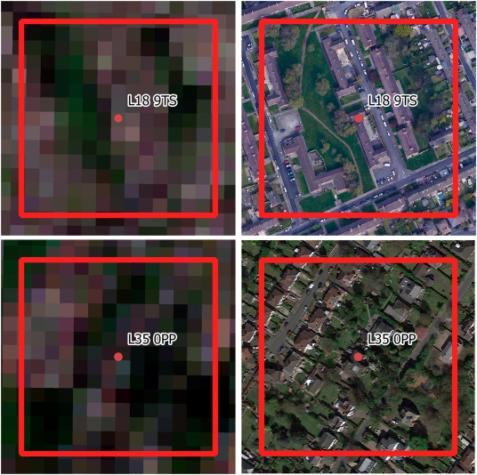
Sentinel 2
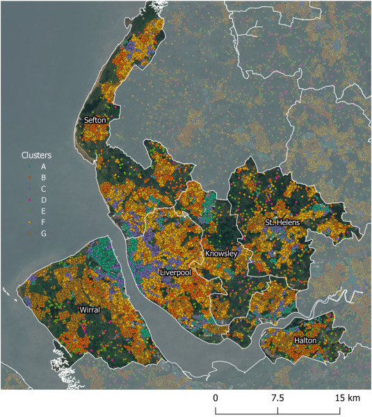
Estimating generalized measures of local neighbourhood context
Detecting urban typology from multispectral satellite imagery using neural networks
|
|
|
|
|
|
|
|
|
|