Using deep learning to identify (urban) form and function in satellite imagery
The case of Great Britain
|
|
|
@darribas]
|
@martinfleis]
|
|
|
|
|
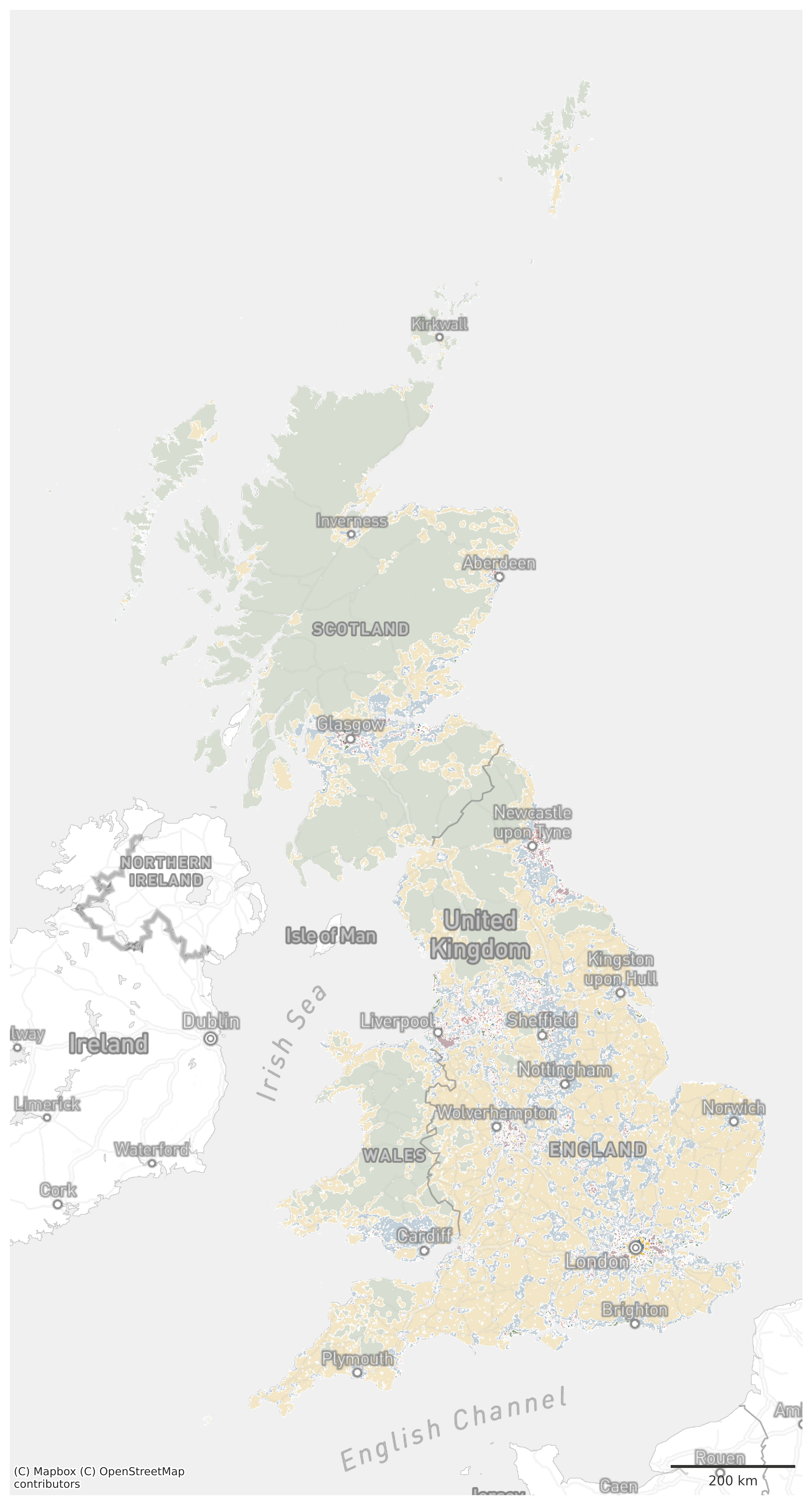
Spatial Signatures
|
BRITISH SIGNATURES Countryside (3) Periphery (4) Urban (9)
|
|


🛰
Sentinel 2
What do we want to do?
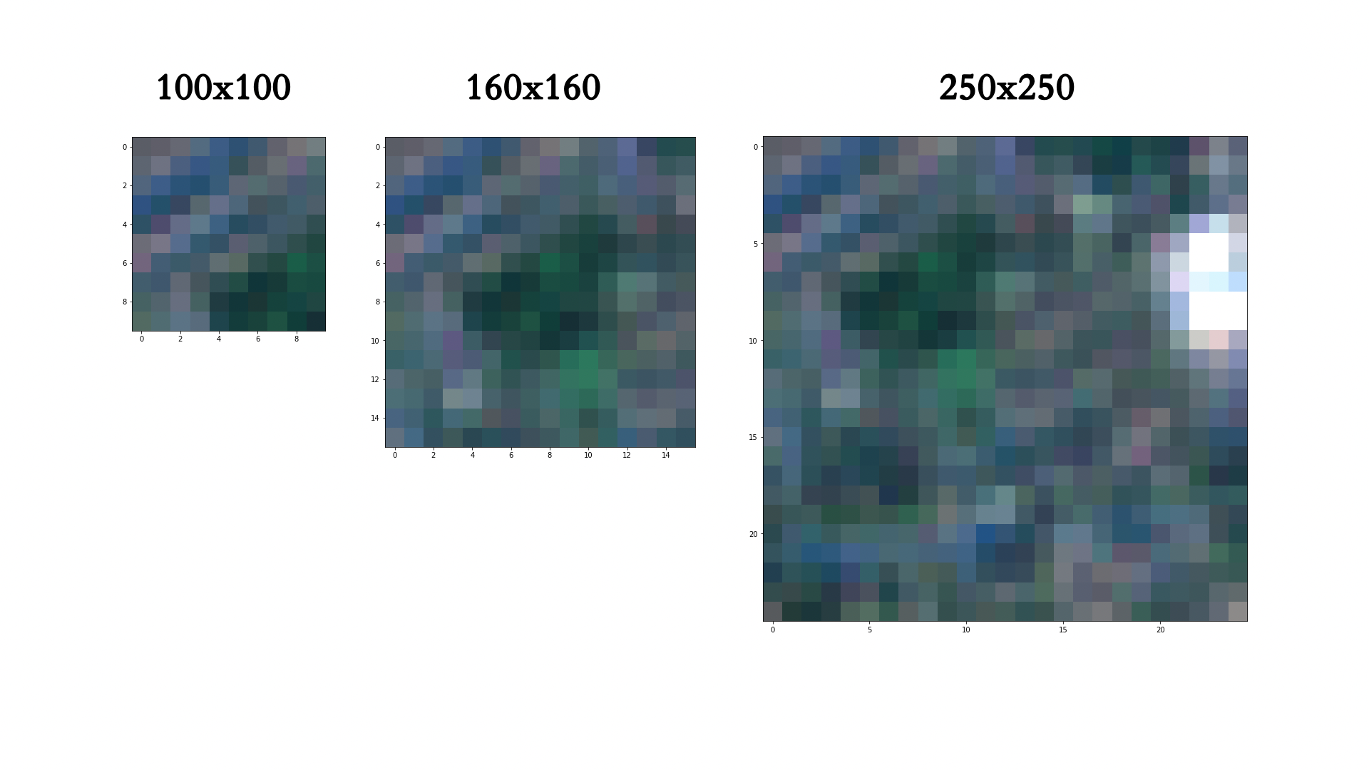
Chip size effect
80x80m: 13760 chips, which is 74 % of maximum
160x160m: 2718 chips within, which is 57 % of maximum
320x320m: 423 chips within, which is 35 % of maximum
640x640m: 38 chips within, which is 13 % of maximum
320x320m, chips capturing the proportion (100% of maximum)
Sliding
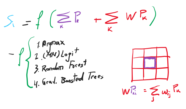
Probability modelling
Using deep learning to identify (urban) form and function in satellite imagery
The case of Great Britain
|
|
|
@darribas]
|
@martinfleis]
|
|
|
|
|